


|
Creating Global Data Extract from an SVG File
The SVG connector can provide for:
q Maps for Choropleth map visualizations (http://en.wikipedia.org/wiki/Choropleth_map)
q Store plans for visualization of crowd flows, client interaction volumes, and so on
q Schematic drawings of process industry facilities for hardware performance monitoring
In Panopticon Designer (Desktop), the SVG XML is translated and the rendering is done by Panopticon Designer (Desktop). For this reason, Panopticon Designer (Desktop) does not support the full scope of the SVG standard definition.
The only element supported is PATH: http://www.w3.org/TR/SVG/paths.html
Steps:
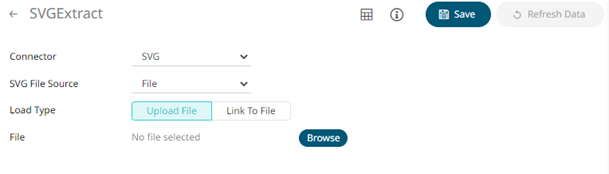
1. On the New Data Extract page, select SVG in the Connector drop-down list.
2. In the d-attribute of the PATH element, the following commands/instructions are supported (both Absolute (upper case) and Relative (lower case):
M,m: http://www.w3.org/TR/SVG/paths.html#PathDataMovetoCommands
Z,z: http://www.w3.org/TR/SVG/paths.html#PathDataClosePathCommand
L,l: http://www.w3.org/TR/SVG/paths.html#PathDataLinetoCommands
H,h: http://www.w3.org/TR/SVG/paths.html#PathDataLinetoCommands
V,v: http://www.w3.org/TR/SVG/paths.html#PathDataLinetoCommands
C,c: http://www.w3.org/TR/SVG/paths.html#PathDataCubicBezierCommands
S,s: http://www.w3.org/TR/SVG/paths.html#PathDataCubicBezierCommands
For example, in order to be rendered this means that a circle must be drawn using the PATH element with a couple of C or S commands. Adding the following XML section to the Worldmap.svg file shipped with Panopticon Designer (Desktop) will produce a circle in the North Sea, right between the UK and Sweden:
<g id="Circle Example">
<path class="SamplePath"
d="M523,118 c0,-10 15,-10 15,0 c0,10 -15,10 -15,0"/
</g>
In the above example, we are using M for absolute coordinates to begin with. Then we use lower case c for relative move compared to the initial coordinate provided by M.
The reference point remains the same within the full extent of a command. This means that when the first c-command is done, and the second c-command starts, the reference point has changed from 523,118 (provided by M) to be 538,118 (equaling the initial starting point plus the relative coordinates specified lastly in the first c-command).
You can also opt to click Browse to browse to the file source. Click Reset to delete the file path on the text box and specify or select a new one.
3. Click
 then
then  to display the data preview.
4. Click  .
The new data extract is added in the Data Extracts list.
.
The new data extract is added in the Data Extracts list.